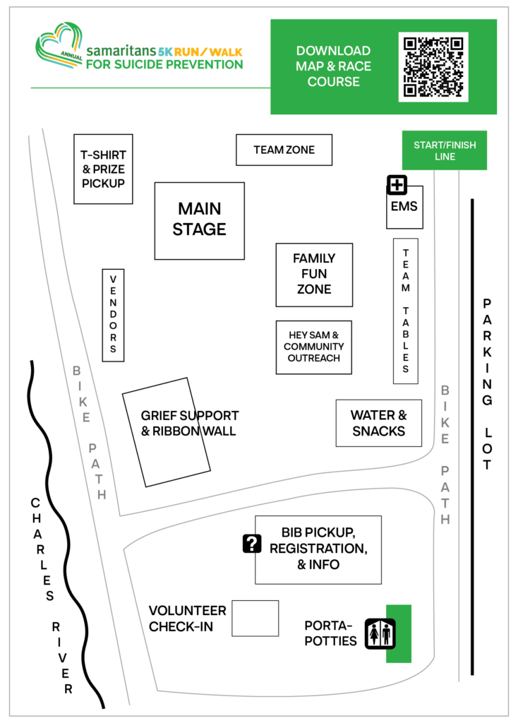
On Saturday, September 28, we are hosting the 26th Annual Samaritans 5K Run/Walk for Suicide Prevention at Artesani Park. View the site map and course route below to find your way around at the event.
Site Map
When you arrive at Artesani Park, head to the bib pickup, registration, and info tent to check in.

Click the image above to open it in a new tab. Download the map as a PDF here.
Race Course
The 5K Run/Walk begins and ends near the parking lot at Artesani Park (point A and G on the map below). It goes northeast along the Charles River, then across Eliot Street Bridge. The course then goes southwest along the Charles River to Arsenal Street Bridge. Cross the bridge, then proceed northeast along the bike path to the finish line.
Note: There is an extension to the racecourse before crossing the Eliot Street bridge, which brings the total mileage to 5 kilometers. The extension is not depicted on the map below, but signage along the course will clearly direct runners to follow the longer route.


